Swanworth Farm BHS TREC 2012
The Swanworth BHS TREC took place on 15-16 September 2012 in support of Epsom Riding for the Disabled Association and others, at Swanworth Farm, near Dorking.
See below for:
- results!
- organiser's report
- POR report (now with concluding comments)
- TD's comments on Bagden Farm checkpoint
- photos from Denbies Farm and Swanworth picnic site checkpoints
- download PTV course plans at levels 1, 2 or 3
- feedback, comments, can be added to the trec-uk.com website or to Facebook
- POR workbook (Excel) (Open Office), containing distances, times, speeds, tests and ticket details (NB different tabbed sheets)
- POR Mastermaps available via Ordnance Survey getamap: Level 1 Novice mastermap, Level 1 Open mastermap, Level 2 mastermap, Level 3 mastermap (requires Silverlight)
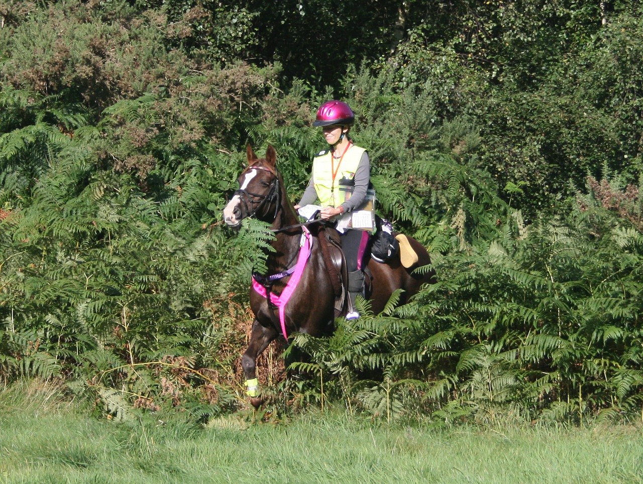
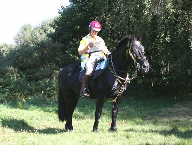
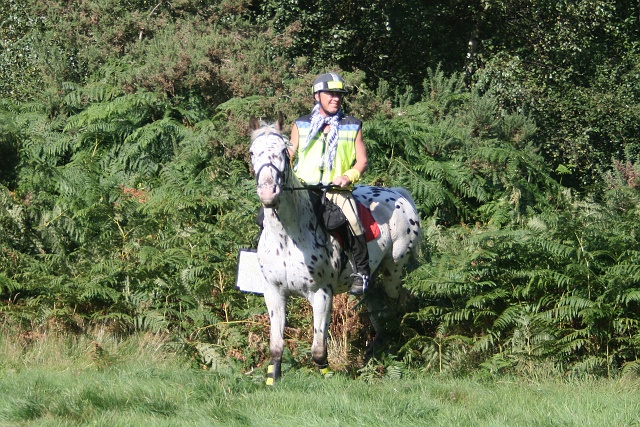
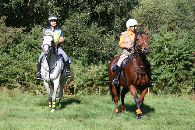
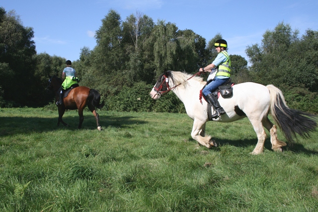
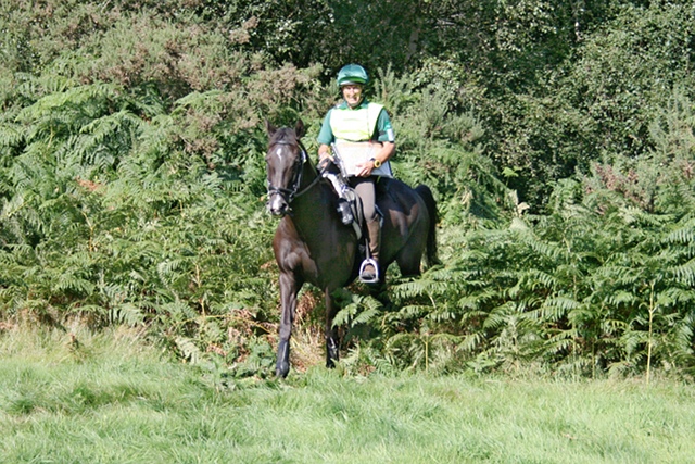
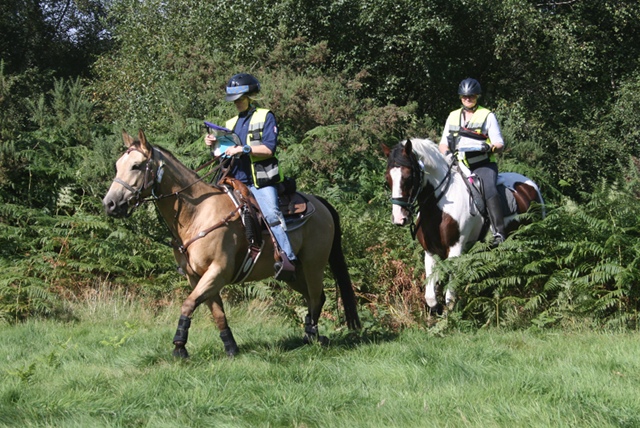
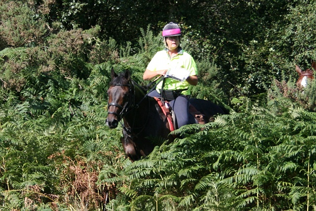
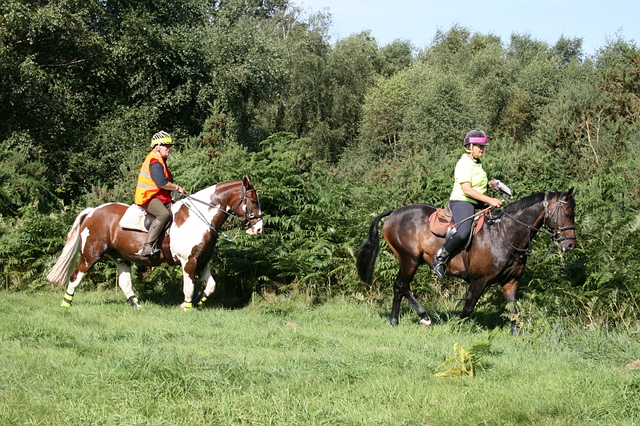
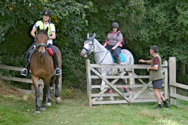
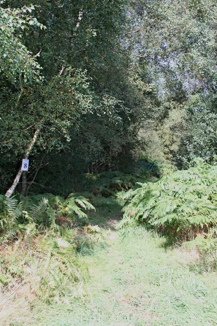
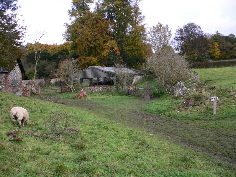
Leigh Nixon, riding Galaxy, is first through the fern and into the first checkpoint on the level 2 and 3 route on Ranmore Common at Denbies Farm.
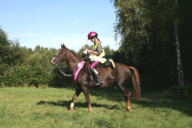
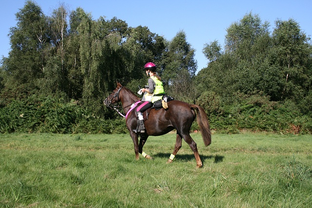
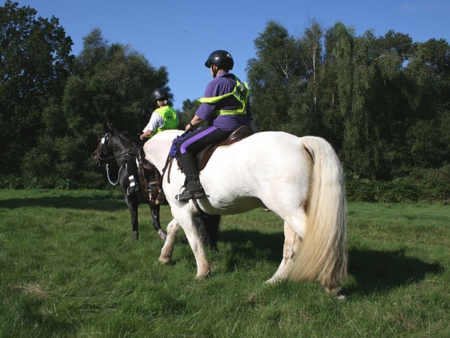
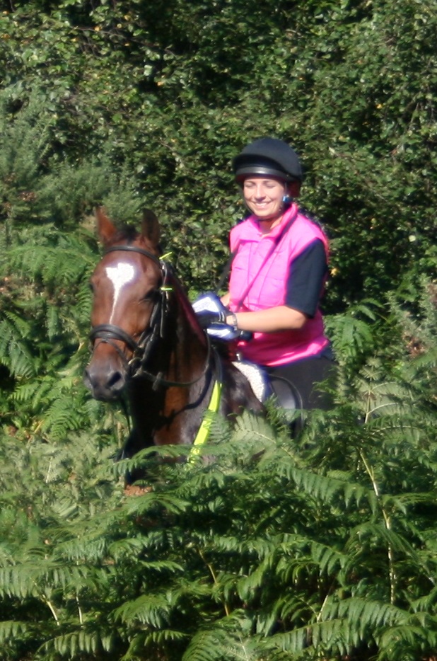
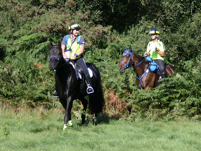
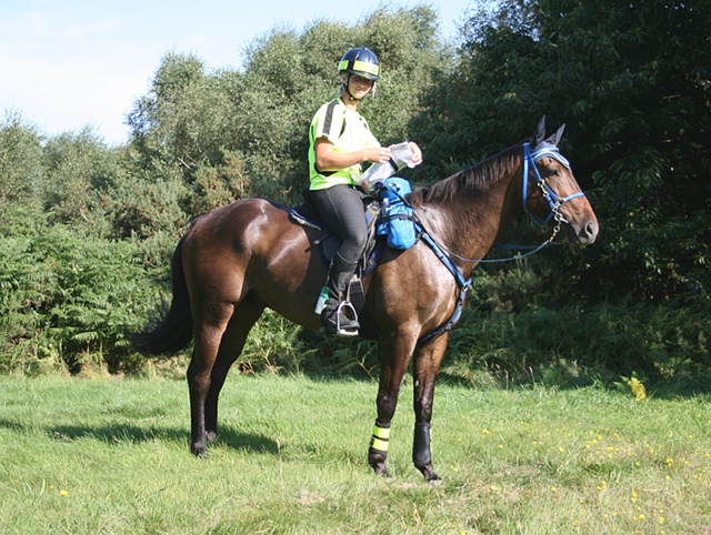
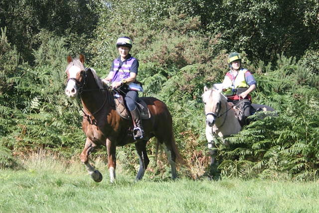
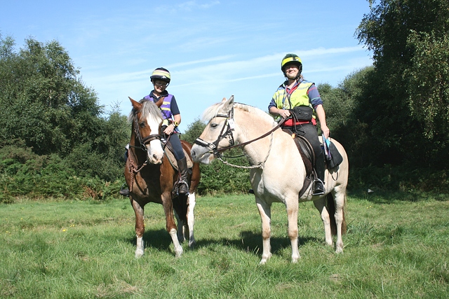
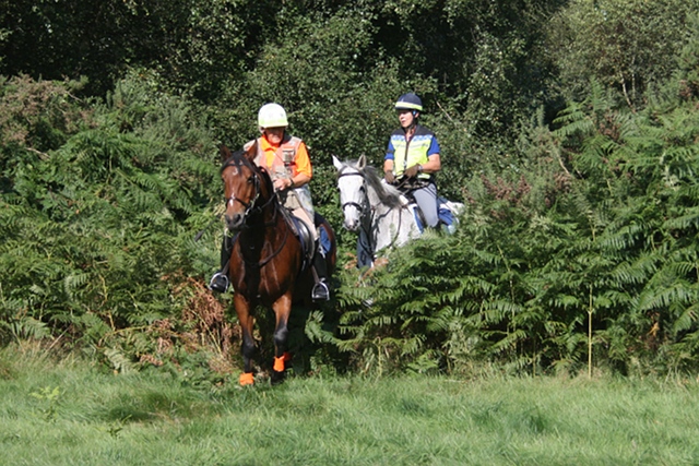
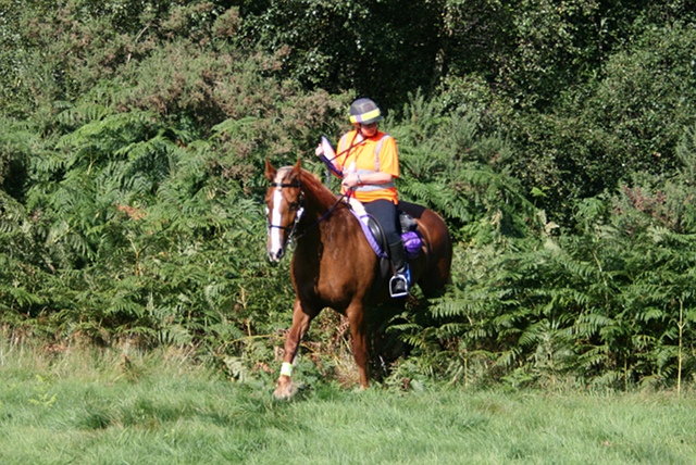
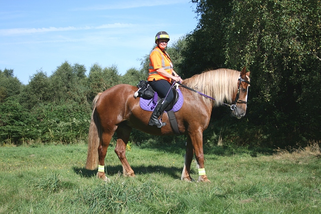
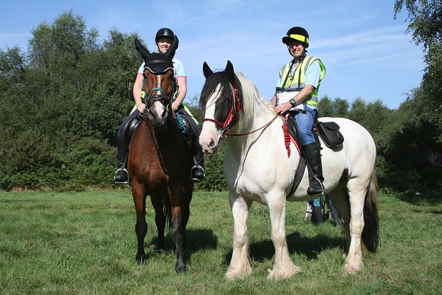
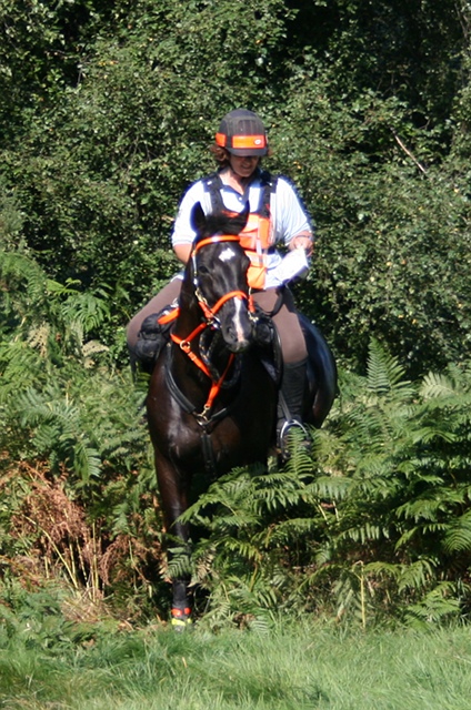
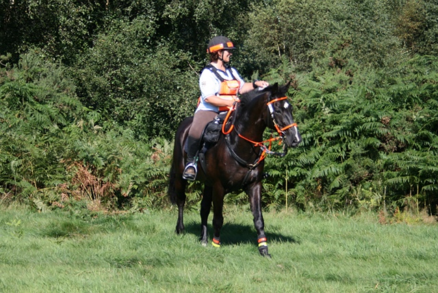
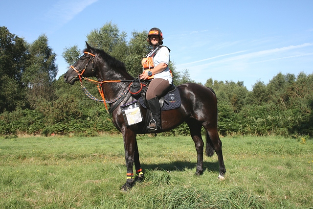
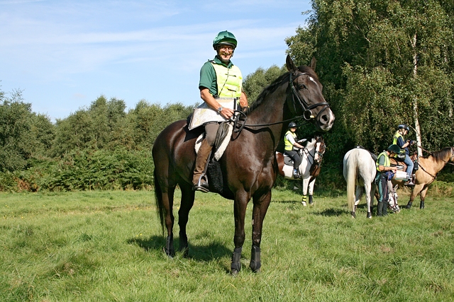
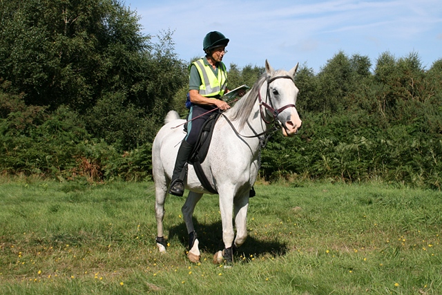
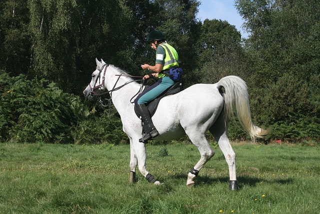
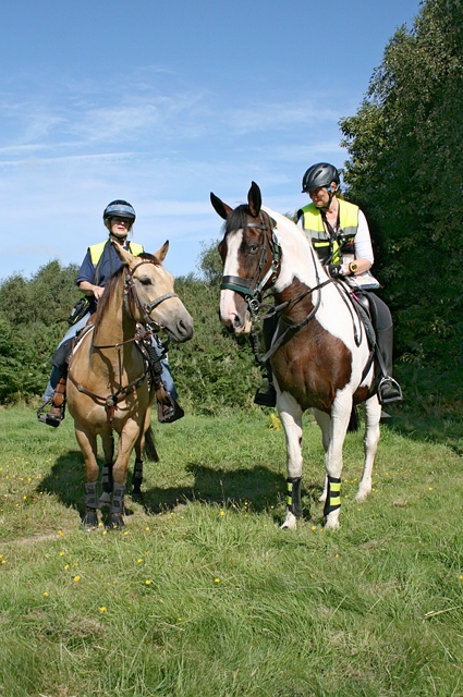
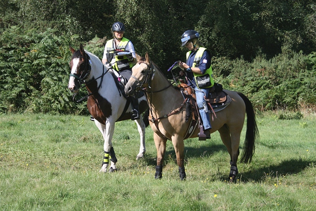
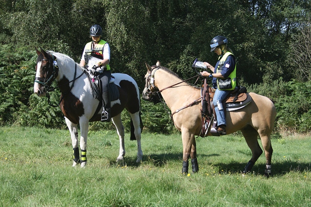
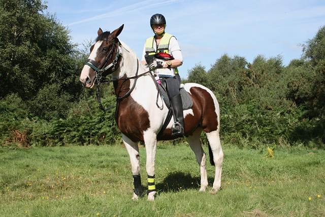
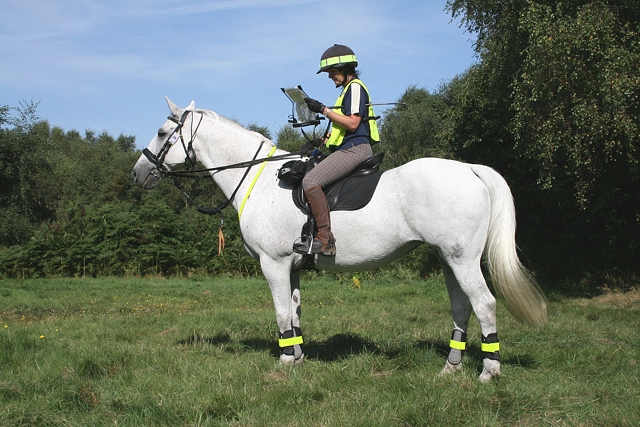
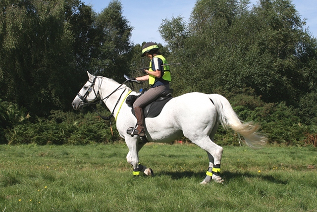
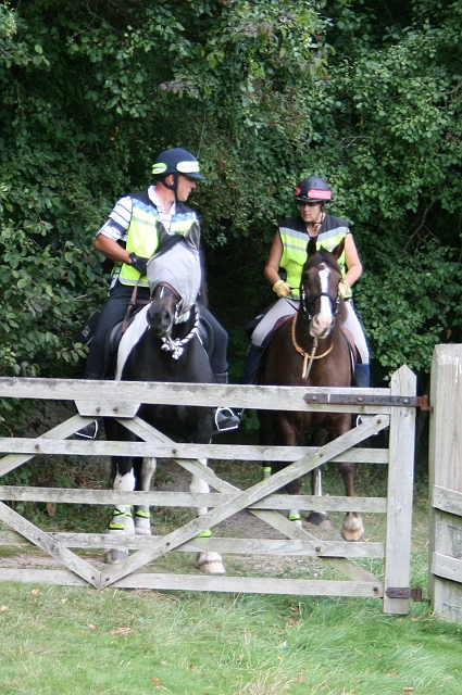
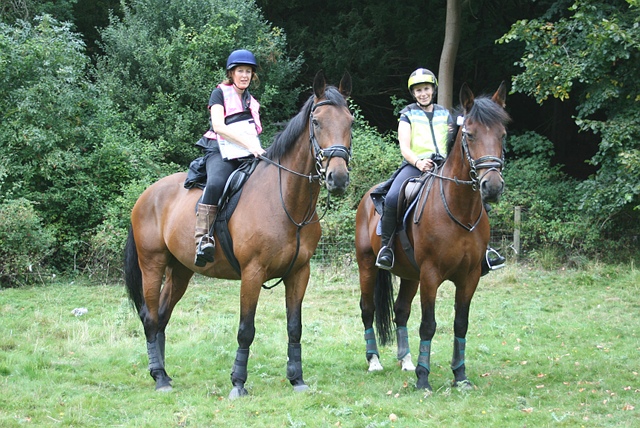
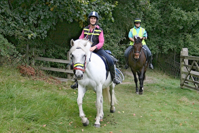
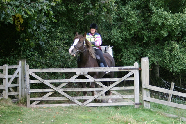
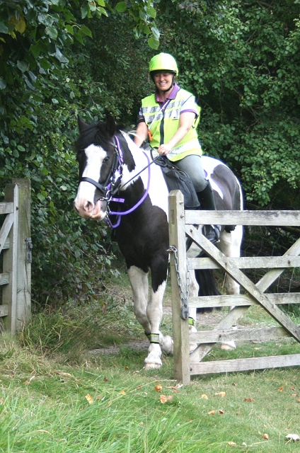
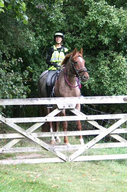
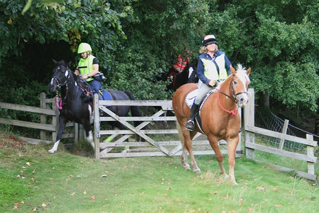
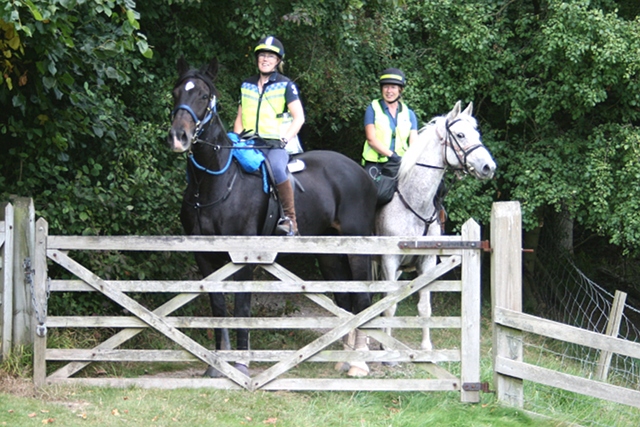
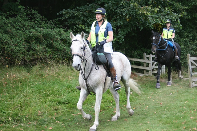
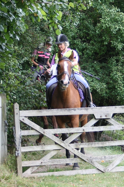
Photos from the Swanworth TREC 2012
Professional photos available shortly from Chris Sterling Photography. Informal photos taken at checkpoint 2 (L2/3) Denbies Farm, and at the final checkpoint (L1 Novice) (Swanworth picnic site). About 50 when I've finished, but this will take time. Attribution wrong? — please drop me an email. Emails of original photos available on request (c.4-8MB).
The POR: Denbies Farm |
||
 |
 |
 |
| 1 Leigh Nixon | 1 Leigh Nixon | 2-3 Yvonne Duffy and Claire Haley |
|
 |
 |
| 2-3 Yvonne Duffy and Claire Haley | 2-3 Yvonne Duffy and Claire Haley | 3 Claire Haley |
 |
 |
 |
| 4 Mary Weston | 5 Donna Leavens | 6,7 Gemma Marriage, Emma Andre |
 |
 |
 |
| 7 Emma Andre | 7 Emma Andre | 7 Emma Andre |
 |
 |
 |
| 8 Steve Moulton | 10-11 Tessa Bayliss and Nichola Peace | 10-11 Tessa Bayliss and Nichola Peace |
 |
 |
 |
| 13-14 Anne Rillie and Wendy Neath | 13-14 Anne Rillie and Wendy Neath | 13-14 Anne Rillie and Wendy Neath |
 |
 |
 |
| 15 Heidi Hooton | 15 Heidi Hooton | 16-17 Lorraine Cook and Graham Clack |
 |
 |
 |
| 16-17 Lorraine Cook and Graham Clack | 19 Veronica Crouch | 19 Veronica Crouch |
 |
 |
 |
| 19 Veronica Crouch | 20 Bob Cripps | 20 Bob Cripps |
 |
 |
 |
| 20 Bob Cripps | 23 Diana Stewart | 23 Diana Stewart |
 |
 |
 |
| 24-25 Di Skippon and Ali Large | 24-25 Di Skippon and Ali Large | 24-25 Di Skippon and Ali Large |
 |
 |
 |
| 24-25 Di Skippon and Ali Large | 25 Ali Large | 26 Natalie Douglas |
 |
 |
 |
| 26 Natalie Douglas | 27 Amanda Marfleet | 27-28 Amanda Marfleet and Vicki Glynn |
The POR: Swanworth picnic site |
||
 |
 |
 |
| 43-44 Janice Bridger and Jacqueline Sandford | 45-46 Michele Kettle and Michael Knott | 50-51 Alison Jelley and Sarah Porter |
 |
 |
 |
| 50-51 Alison Jelley and Sarah Porter | 54,61 Angela Rundle and Stacey Collins | 57-58 Yvonne Waltham and Louisa Whittaker |
 |
 |
 |
| 59 Gail Ditchfield | 60 Harriet Graeme | 64-65 Adele Graham and Sarah Hunter |
 |
 |
 |
| 69-70 Lynn Burgess and Julie Johnson | 71-72 Corinna Furse and Di Warner | 73-74 Sara Gallagher and Karen Woolnough |
 |
 |
|
| 73-74 Sara Gallagher and Karen Woolnough | u/k | |
Swanworth TREC Organiser's Report
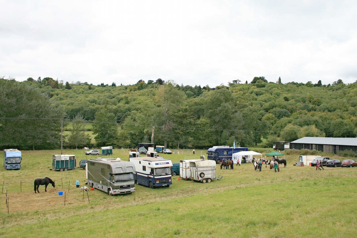
The coral field, with map room right
My TREC 'weekend' started for real on the Wednesday, having finished work on Tuesday. My first job was to sort out the starting times with Pauline Humphries, our Secretary, also seen in the Map Room on Saturday and help her get them emailed out to the competitors. That seemed to go quite smoothly for once!
Thursday morning was spent raiding the Cash & Carry and Tesco's for food and drink for the weekend and then off to Toni and Ben's to start the food prep for Saturday evening's Social. My mum, Renate Konn, later to be seen in the Map Room, also helped with the food prep. Again, for once this seemed to run smoothly and I was allowed to return home at 11.15pm (very early for us!)
Once home, I continued getting paperwork ready and shifting stuff downstairs ready to load onto my trusty green van [Is that the trusty green van that spent a fortnight at the garage earlier this month? Ed] in the morning.
Friday morning and dear Ben arrived to help me load the van (thanks Ben) and I finally made it to the venue to meet up with Steve Moulton who was helping me with the set up and supporting me generally. We did a bit of tooing and froing to get trailers various (loaded with PTV equipment and other stuff) to the venue and on our return we were met with the lovely sight of Bob Cripps, ready and willing to help. Bob and I flew around the landscape putting out signs, leaving Steve to erect his marquee — the Map Room.
By the time Bob and I had finished, competitors had started arriving and were asking what they could do to help, so thanks go to Emma Andre, Yvonne Duffy and Bob Cripps for helping me offload PTV obstacles in roughly the right places ready for Zoe White and Susan Weston to course build on Saturday.
Competitors by this time were asking for their Competitor Packs which I hadn't had time to collate! So Veronica Crouch very kindly helped me put them together.
Saturday morning and at last it was beginning to feel like a TREC! John Maclean helped me collate the day's clipboards and prepare the Map Room for the day's action while Diana Maclean fed me some breakfast! And then it was time to welcome back people that I perhaps hadn't seen since last year!
So thanks must go to the following people:
- Emma Kareno and Katie Weston for doing the Equipment Check and various people — they kept changing for Horse Holding.
- Pauline Humphries and Renate Konn for looking after the Map Room.
- John Maclean for manning a ticket which hardly anyone routed into correctly in Norbury Park.
- Chrissie Nicholls and Emily Lacy for thankfully marshalling the junction where Crabtree Lane joins Chapel Lane as unbeknown to us, there was a 'minor' cycle race in progress! Emily went up to Pilgrims Close to make sure that our competitors made it safely onto the private estate there.
- Hugh Craddock (our fantastic traceur) and Lynn Burgess for judging the checkpoint near Denbies Farm and also for putting up and taking down the tickets on Ranmore Common.
- Michele Kettle for looking after a very lonely checkpoint for Level 3 riders only, near White Down Road, Abinger.
- Joy Taylor for starting the Bearings Test from Haney's, near Dogkennel Green.
- Jo and Colin Cox for coping with the chaos at Stonyrock Car Park and for keeping me company while I was waiting for the remaining Level 3 riders to arrive at the Vet Check.
- Pat and John Cooper, all the way from Lincolnshire and looking after the Bagden Farm checkpoint — please see separate note below for separate issues regarding this checkpoint.
- Emma Kareno and Jill Perry for judging the Norbury Sawmill checkpoint. Emma is completely new to TREC and I was trying to give her a general overview of TREC over the weekend.
- Jo Carr for being at the Picnic site at the top of Swanworth Farm and being our final checkpoint for all levels on Saturday.
Saturday did have one or two hiccoughs but generally everything seemed to go well on the POR.
Meanwhile, Zoe and Susan had been busy and together with George and Trish Goddard and Elaine Briggs from Epsom RDA and Kay Kitson, our TD, had finished building the CoP and PTV courses ready for Kay to take the Official Course Walk at 6pm while Joy Taylor and I got on with the scoring for the POR so that people could have a look at the provisional results after dinner.
Dinner was merrily bubbling away and Toni and Ben Izard were very busy getting things ready for when competitors returned from their course walk.
Grateful thanks to Jill Perry, who acted as front of house, ticking diners off lists and relieving them off money very aptly if they hadn't already paid! Also to people various who were selling raffle tickets in aid of the Brooke Hospital for Animals. We raised £61 for the Brooke and thanks to Petra Ingram, their Chief Executive Director, for calling the raffle. Also to John Maclean for providing the entertainment with his accordion, once again.
The food was excellent (I was only the onion chopper and meat sealer, so didn't have that much to do with it). Grateful thanks to Toni and Ben, who specialise in providing organic and locally grown produce for functions in general. They call themselves Fab Food. Please contact Toni on 07749 633973 if you would like them to do something for you.
The Poached Salmon had been cooked and prepared by Steve Moulton in his lorry — amazing what you can produce in a lorry!!
Up at almost the crack of dawn on Sunday morning to finish preparing the days clipboards with Jill Perry and give a Judge's Briefing at 8.15am prior to the start of the Level 1 CoP and PTV at 9am. Thanks here go largely to the Level 2 and 3 competitors who very good naturedly gave up their free time:
- Control of Paces: Andrea Foreman and Claire Rivett
- Start: Jo Carr
- Low Branches: Diana Stewart — sorry Di, but you are tall — you must be expert at judging this one by now!
- Bank: Bob Cripps
- Corridor: Emma Kareno
- Neck Rein: Julie Sadler
- Side Pass: Gemma Marriage
- Bending: Nicki Woods
- S Bend: Veronica Crouch
- Led S Bend: Joy Taylor
- Mount from a Block: Tania Draper
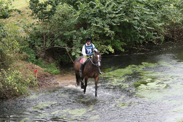
- Water Crossing: Jenny Holmes
- Rein back: Heidi Hooton
- Ridden Incline Down: Clare Reynolds
- Maypole: Donna Leavens
- Ridden Incline Up: Vic Baylis
- Log: Elaine Finch
- Ridden Immobility: Susan Bowen
- Finish: Emma Andre
The CoP for all levels was a 150m corridor with a right hand bend in the canter and a left hand bend in the walk. The top score at Level 1 went to Lynda Eastwood with 44, second place went to Stacey Collins on 39, and Alison Jelley in third place with 38.
For the Level 1s, we had planned a fairly straightforward course. I was slightly dismayed to find that 7 people wrong routed at the Incline Down/Maypole/Incline Up section and therefore lost all their points. It turns out that these people had not walked the course beforehand and I think that a valuable lesson should be learnt here.
The Low Branches were generally completed in trot, with just a handful successfully completing in canter. These were Lynda Eastwood, Emily Dolby-Brown, Suzanne Harrison and Romi Costantini. The Bank was successfully ridden by most. The Corridor which was on a straight approach with level ground for Level 1 was largely completed in trot, while the majority scored 10 for the Neck Rein, a new obstacle this year. I was pleasantly surprised to see that there were a lot of scores for Side Pass, which, unless you have specifically trained your horse to do it, can be very difficult to score on at all as horses generally don't appreciate going fully sideways with a pole between their legs! The Bending was mostly completed in trot with one successful canter from Carol Dolby-Brown. S Bend results were variable with the Led S Bend scoring lower than the ridden version thus proving that it is more difficult do this led than ridden. The ridden version was on the ground, so any touch at all resulted in the deduction of effectiveness points while the Led version was raised, meaning that the horse actually had to knock a side down to lose effectiveness points, while touches are penalised in the style section. Mount from a Block was from the offside, which I must admit, I thought was rather demanding for Level 1, however, Zoe was our PTV co-ordinator and decisions like this are up to her! [Quite right too: anyone can practise offside mount without any special arrangements. Ed] Scores here were not surprisingly, a little on the low side!
River Crossing: 75 Derek Amesbury |
I'm pleased to see that 24 out of 49 Level 1s scored something on the Water Crossing which looked rather scary, having a steep entrance and exit, green boulders at the bottom, running water and a dinghy floating around just to cap it all (not to mention the photographer on the bridge)! Thanks here must go to Steve Moulton and Cocoa Pop who had tested the Water Crossing on Friday while we were putting out the obstacles to make sure that it was safe to use. Steve took a 6 point penalty on the Water Crossing (shown in Tack/ Vet penalties) because of this. |
There were some nice scores at the Rein Back, another difficult obstacle to score on and this one was pointing into a dead end of fallen tree. A nice canter down the side of the field to the Ridden Incline Down which had variable scores, the Maypole which was mostly completed in trot and the Ridden Incline Up, which again had variable scores. The Log rode very well with most people scoring 10 and the final obstacle was the Ridden Immobility where the less experienced were scoring the 10s and the more experienced had a variety of scores. There was a time limit of 10 minutes for Level 1 and sadly only 12 out of 49 did not get any time penalties.
In the meantime, Renate Konn and Jim Bowers had been looking after the Map Room with Natalie Douglas doing the Level 1 Equipment Check with Sarah Reith and Emily Lacy amongst others Horse Holding.
On Sunday, John Maclean and Jill Perry manned a Checkpoint at Bagden Farm, following a much less complicated route than the previous day, while Kay Kitson and Helen Bolton went to the Norbury Sawmill Checkpoint. Hugh Craddock meanwhile had a good view from the final Checkpoint at the Picnic Site at the top of Swanworth Farm.
Please see Hugh's separate POR report below for full details of the POR. Suffice to say that navigational problems were found by most competitors with the top POR score of the weekend being achieved by Stacey Collins (Level 1) of 185.
The CoP and PTV judges then returned to the Map Room for lunch and a chat, then some went off to get their horses ready for their own CoP and PTV while others returned to the course to carry on judging.
In the afternoon, thanks go to the following people for giving up their Sunday afternoon:
- Control of Paces: Jo Lee and Jane Sanders from Epsom RDA
- Start: Sue Bowen
- Low Branches: Clare Reynolds
- Bank and Corridor: Tania Draper
- Neck Rein: Jo Carr
- Side Pass: Elaine Briggs, also our Health and Safety person
- Bending: Sarah Leggat
- Ridden S Bend and Led S Bend: Joy Taylor
- Mount from a Block: Emma Kareno
- Water Crossing: Elaine Finch
- Reinback: Jenny Holmes
- Ridden Incline Down, Maypole and Ridden Incline up: Trevor Brown and Carol and Emily Dolby-Brown
- Log: Claire Rivett
- Ridden Immobility: Andrea Foreman
- Finish: Vic Baylis
The CoP for Levels 2 and 3 was the same as for Level 1 with most people attaining a score. Amanda Marfleet who only started competing at TREC this year and who has already qualified for the Champs in Wales next year got the top score of 45, Tessa Baylis was a close second with 41 and Nichola Peace was third with 38.
Low Branches were completed with variable scores although all successful Level 3s did it at canter. The Corridor for Level 2 was next. This had been placed halfway up the slope of the Bank with the exit flags backing on to the entry flags for the Bank, so to complete successfully you had to do both obstacles in the same pace. The Individual class seem to have opted to do this at a trot, while the Pairs class appear to have walked them. The Pairs class generally got better points for the bank and therefore their tactics paid off! The Level 3s had to complete the Bank first and follow this with a downhill Corridor. They did this in a mixture of walk and trot and got good results for both. The points for Neck Rein were variable for both levels with Level 2 excelling on the Side Pass with Wendy Neath getting 10 points. A few 10s were scored on the Bending which was set going across the field towards a tree. Level 2 Individual got the best scores on the Ridden S Bend while score for the Led S Bend were variable. Again the scores for Mount from a Block from the Offside were quite low, but 15 out of 20 got good points for their Water Crossing. Reinback was next, with 3 lots of 10 points being given! These went to Steve Moulton, Donna Skinsley and Veronica Crouch. The Ride Down scored good points and 3 people scored 10 on the Maypole — Bob Cripps, Nichola Peace and Amanda Marfleet. The Ride Up scored nearly all 10s. The Log jumps rode well but the Ridden Immobility scores were variable.
10 out of the 20 that completed all three phases did so within the time limits of eight minutes for Level 3 and nine minutes for Level 2.
Don't forget to look at our photographer, Chris Sterling's website: www.chrissterlingphotography.com
Huge thanks to everyone who stayed behind to mastermind The Great Clear Up! Especially to Zoe White, Graham Clack, Sue Bowen, Vicki Glynn and Diana Stewart and any and everyone else that I have missed — it is not intentional!
Thanks also to Claire Haley who came back to the venue having dropped Ben back to the yard [Assume that's the four legged Ben this time? Ed] and helped Steve with the scoring.
Steve and I finally finished the scoring at around 9pm and then collapsed in an exhausted heap after a sausage sandwich — not quite on a par with the previous night's efforts but delicious never the less!!!
I would like in particular to thank all those who have given their time and brain power to designing this TREC and getting permissions sorted to use the land that we did. Amongst them are Kay Kitson, our TD who stepped in at the last moment, Hugh Craddock, our Traceur, Zoe White, our PTV Co-ordinator, Pauline Humphries, our Secretary who has sadly decided to step down after this year so we are looking for someone to replace her — any volunteers — please contact me — and Stella Milne who wrote to the landowners and smoothed our path.
Last but not least, I must thank the generosity of the landowners who made this event possible. Amongst them The National Trust, Surrey Wildlife Trust and Surrey County Council, Westhumble Residents' Field Management Company, Mr and Mrs Garnett of Haney's, the residents of Pilgrims Way and Close, Denbies Vineyard and of course our host Nick Bullen, who also did quite a bit of preparation of his land to make it usable for us.
I haven't as yet completed the finances but we will hope to make a donation to Epsom RDA of at least £2,000.
Bye for now and hope to see you next year.
Jenny Snowdon
On behalf of The Balanced TREC
Mob: 07958 407594
Swanworth TREC POR 2012
From the Traceur
Updated 18 September
This year's POR took place in and around the parkland of Norbury, Polesden Lacey, and Ranmore Common, on the west side of the Mole Gap near Dorking. Some 540 hectares of Norbury Park, including Swanworth Farm and adjacent farmland, were bought by Surrey County Council in 1930 for just £85,000: the park is now leased to Surrey Wildlife Trust, and the farms sub-let to tenants. Polesden Lacey and the Ranmore estate is owned by the National Trust, with the eastern end forming part of the Denbies Estate, which manages over 100 hectares of vineyards visible on the west side of the Mole Gap: the largest vineyard in the United Kingdom. Use of non-statutory paths on the Norbury, Ranmore and Denbies estates was by kind permission of Surrey Wildlife Trust, the National Trust and the Denbies Estate respectively, while this year's Swanworth TREC is indebted to Nick Bullen, the tenant of Swanworth Farm, for use of the Farm and its fields.
The POR led riders out of the map room immediately over the River Mole, heading west towards the wooded slopes of Norbury Park. On reaching the track south from the picnic site, riders needed to cross the track, and follow it from within the field on the right hand side. For Level 1s, there was planned to be a ticket near Lodge Farm to reward those who did not ride along the track, but its placing was overlooked on Sunday morning: observation suggests nearly all riders would have missed it! After passing Lodge Farm, riders headed south-west across the field, with the steep side of Ham Bank leading down to the River Mole below, before leaving the field through a gate in the south-east corner. Here, riders turned right, along a path outside the field, before turning sharp left along the concessionary horse ride, Six Mile Bottom, towards Westhumble. Shortly before the ride joins Crabtree Lane, riders needed to look out for a path leading to the right, which crosses the south carriage drive to Norbury House (now not used by vehicular traffic) and joins Crabtree Lane just a short way above the junction. John Maclean operated a manned ticket here on Saturday, while on Sunday, a ticket was displayed. Some level 1 riders went wrong here, assuming that the carriage drive, which is tarred, was indeed Crabtree Lane, and turned along it, heading off towards Norbury Park sawmill. With hindsight, an understandable error, although riders needed to cross this drive to reach Crabtree Lane, and the barrier across the drive just below, and the gentler ascent than shown on the map for Crabtree Lane, should have sounded a warning.
Level 1
Level 1 riders here turned right, up Crabtree Lane, as far as Crabtree Cottages, where they turned right, following the Lane, now a public bridleway north, initially uphill, and then an initially gentle drop towards Bookham Wood: later, the slope increases, and erosion requires riders to descend at a careful walk. Competitors turned left along the near side of Bookham Wood, where there was an opportunity for a trot or canter, before joining a narrow enclosed path along the back of Bridleways Equestrian Centre (marked as Phoenice Farm on the map), then steeply downhill through Chapelhill Wood. These woods marked riders' entry onto the extensive Ranmore estate, which is focused on Polesden Lacey, a regency country house set in the Surrey Hills but close to London formerly owned by an Edwardian society hostess.
At the bottom of the descent, two awkward bridlegates provided access onto Chapel Lane, and almost directly across onto the bridleway past Bagden Farm. Just beyond, Level 1 Open riders were expected to ignore the ticket on display in the farmyard, and go round the back, while Level 1 Novice competitors were required to go through the farmyard (no ticket here on Sunday) and eschew the permissive path at the back. In either case, a checkpoint was located just after the farm yard, and riders were here reunited with the longer routes followed by Levels 2 and 3.
Levels 2 and 3
Level 2 and 3 riders turned left down Crabtree Lane, before reaching Westhumble Street at the bridge next to the ornate railway station, and an archway to a private estate opposite. Here, they turned right up Chapel Lane, shortly turning left into the sanctuary of Pilgrims Way, a private road maintained by the residents, and with access to it by their kind permission. A right turn took them steeply down Pilgrims Close, and then shortly left into Adlers Lane, still a public road, which formerly continued east to the main road near North Lodge before being severed by the railway. At the end of the Lane, riders were able to cross the field south to the north carriage drive to Denbies: the field is owned by, and permission was kindly granted by, the Westhumble residents' field management company. Competitors turned right along the old carriage drive (formerly providing access to Denbies House), and then left along the footpath, to gain access to the perimeter of the main vineyards grouped around the Denbies visitor centre. This section of route, from the carriage drive to the first checkpoint, was by kind permission of the Denbies Estate: between Westhumble and Ranmore Common Road, only those sections of the route on public bridleway or public road are normally available to horse riders. Competitors needed to turn right along the edge of the vineyard here, following the boundary round to the left at the top, and joining the public bridleway ascending from the visitor centre. There was an added excitement here, as road trains - a Land Rover pulling a string of carriages - ascend and descend across the route every hour during the day. Suitably armed with the likely times, keeping an alert watch, and with road train drivers briefed, riders followed the concrete drive a short way, before continuing up the bridleway to Ranmore Common, crossing the road train route again slightly higher up. On reaching the summit, riders negotiated a junction of paths, and assuming they took the correct right hand one ahead, needed to look carefully for a now overgrown crossroads, with the path ascending the coombe from Keeper's Cottage on the right now entirely overgrown, and the required turning to the left almost as bad. Continuing up this path, and keeping slightly right, the path is eventually blocked by gorse and bracken, but it was possible (for the first riders) to push through out onto the grassy plain, and right route into the waiting checkpoint. Which, remarkably, is what the vast majority of riders successfully did, with only a handful wrong-routing via the concrete road, and a couple more via the marked return route.
Level 2/3 ticket after Denbies Farm checkpoint |
Riders now needed to ride a short way south-west along the plain before turning right down the next path, fortunately better defined than the last - but not too soon, as that would miss the ticket, seen opposite! Resuming the original course along the bridleway, competitors crossed Ranmore Common Road the first time, and soon reached the broad grassy verges along the Road which is characteristic of the summit of Ranmore Common. There was a good opportunity for a canter here, before looking out for a detour to the north of the main ride just opposite Old Post Office cottage, with a ticket to verify the correct route back onto the Road. Riders crossed the road just short of the characteristic Fox Cottages, before continuing for nearly (or more than) one kilometre along the recently mown grassy strip of common between the road and the woodland to the south. |
On reaching the junction with Hole Hill Lane, a byway open to all traffic, level 3s embarked on a longer route down off the scarp and west to Abinger Roughs, while level 2s cut out this detour and two checkpoints. Taking the level 2 route as far as the checkpoint at Stonyrock car park, where it was reunited with level 3, level 2 riders continued over Hole Hill Lane, and should have crossed back over Ranmore Common Road for the third and final time just short of a block of scrub and woodland which all but prevents further passage along this side of the road. Riders then cut across to a path initially dropping down before rising up the other side of a small valley: as this path turned right down the valley, as shown on the map, they should have taken a smaller path straight on, and then as this path too turned right, taken an unassuming path on the left with continued in the same general direction as before. This path negotiated the remains of a fallen tree, and passed a ticket, before emerging at one of several confusing junctions of grassy paths on this part of Ranmore Common. The correct route remained roughly straight ahead, soon arriving at another junction, where the onward route appeared blocked by scrub. Careful study of the master map would have revealed a slight nick in the route here, requiring several steps to the right, and then a hidden sharp left turn round the block of scrub, to resume the original direction. Eventually, the path descended to Hogden Lane, an unmade byway open to all traffic much frequented by motor vehicles at weekends, crossing straight over and climbing to Stonyrock Lane (confusingly, also known as Hogden Lane), where riders should have turned left along the road, alongside Stonyrock car park opposite, before turning right at the end of the car park, over the ditch, and into the checkpoint.
Level 3 riders instead turned left along Hole Hill Lane, soon going down Hole Hill, a steep, chalky and sometimes difficult descent of the North Downs to its junction with a public bridleway running along the foot of the scarp. Here, a right turn was required, soon leaving behind the bridleway (which turns left to Stockman's), and continuing along a National Trust permissive bridleway still along the foot of the scarp. This eventually joined with another public bridleway which descends the scarp, and continues south to Park Farm, before picking up an enclosed path along the north edge of Dearleap Wood and the southern edge of a large field. This path emerged at White Down Road, with a checkpoint just the other side of the crossing. All level 3 riders right-routed here, as expected.
On leaving the checkpoint, competitors passed the first of six grid reference sites identified in a questionnaire: this one referred to the Bishop Wilberforce memorial opposite Leasers Barn. Riders then continued west along a straightforward route over Abinger Roughs and Broomy Downs, before turning north to join the farm track to New Barn, noting the weight restriction on the bridge over the railway line as the second grid reference. An abortive initial climb of the scarp then led to a short stretch down again (necessitated by avoiding the railway crossing at Hackhurst Farm on the more evenly graded approach), before noting the answer to the third grid reference question and then turning right to climbe to the scarp on the heavily overgrown bridleway 3. On reaching the Drove Road, a byway along the top of the downs, riders turned right, with a further right turn into bridleway 4 - but not before identifying the notice on a now blocked turning to the right, printed on a barrier. Riders now proceeded south and then west through Old Simms Copse. Unfortunately, bridleway 7, heading north back to the Drove Road, had recently been blocked by a tree fall, and level 3 riders had to use their initiative to find an alternative route, while still pausing at the junction of the Drove Road with White Down Road to check the width restriction on vehicles entering the former.
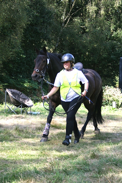
Level 3 vet check at Stonyrock car park: 3 Claire Haley with Ben |
Continuing north up White Down Road, across the junction with Ranmore Common Road and Crocknorth Road into Critten Lane, competitors turned right into a narrow bridleway uphill to Dogkennel Green, with another grid reference located on Limekiln Farm. Riders then turned left onto High Barn Road, and shortly right down the private drive to Haneys, by kind permission of the owners, and into the level 3 checkpoint. This was the start of the bearings test, comprising 1,329 metre route up to and across Stonyrock Plain at the western end of Ranmore Common, where a large number of paths are mown each summer by the National Trust, creating a confusing environment for bearings. Those successfully completing the bearings test navigated into the same checkpoint at Stonyrock car park as met earlier on the level 2 route, although via just one of several likely entry points. For level 3 riders, the checkpoint also brought the veterinary check, administered by Jenny herself (no-one knows how Jenny appears in so many places seemingly at the same time): see photo opposite. |
Levels 2 and 3
Competitors at levels 2 and 3 now followed the same route back to Swanworth Farm, leaving the checkpoint and car park along a grassy path parallel to the road as far as Gatehouse cottage, and then the road itself, turning right into Garlic Hill, and so down to Hogden Lane, the byway which level 2s had crossed earlier. A short turn left down the land, and then right up a path back onto Ranmore Common followed, with a slight wiggle from the main path delivering no tickets but only possible time penalties. Riders should have eventually emerged at Ranmore Common Road directly opposite the top of Hole Hill Lane, before turning sharp left and north, then back right, then resuming north to pick up a bridleway initially down a coombe, and then contouring round the spur and into another coombe, to reach Tanners Hatch youth hostel. It was important here to pick up a track running above the main bridleway east, to emerge into a field at the foot of Dorking Wood, with a direct course across the field to the west end of the disused farm yard behind Bagden Farm.
All levels
Unfortunately, owing to a misunderstanding early on Saturday, the arrangements for a checkpoint and ticket at Bagden farm yard went awry, and no penalties could be imposed (see our technical delegate's report below). Suffice to say, riders at levels 2 and 3 were required to eschew the checkpoint on arrival, to turn right and ride around the back of the farm yard, to turn left and left again into and across the old farm yard, where a ticket was displayed, and then to exit the farm yard and enter the checkpoint. Although no penalties were imposed, some level 2 and 3 competitors were reported to have arrived at the checkpoint via the nearby bridleway, rather than across the field. Level 1 Open competitors on the Saturday, approaching from Bagden Hill, were simply required to ride past the farm yard, and turn right along the back of the farm yard, and into the checkpoint, missing the (in effect) bad ticket.
Leaving the checkpoint, there was a good opportunity for a canter west across the field to the gate into Connicut Lane, then turning right and uphill, passing under the ornamental bridge which carries the carriage drive to Polesden Lacey. After nearly 2 kilometres, Connicut Lane emerges onto Polesden Road, where the map encouraged riders to cross over and use the broad margin on the north side of the road down to the junction with Dorking Road. Crossing straight over into Admirals Road, another byway open to all traffic, riders continued along the byway for 1.2 kilometres, before turning right down to Roaringhouse Farm, and crossing straight over the bridleway 106 at the bottom of the valley to climb another narrow path, just to the right of the granary (on staddle stones) to cross over the spur and down to bridleway 105, a flinty track gently ascending the adjacent coombe. Here, again, riders needed to cross straight over, to pick up bridleway 105 (the track up the valley continues as bridleway 62a) as it climbed the side of the coombe through an area of scrub. This section proved tricky for many, as the public bridleway is shown as adopting an alignment further to the south-west than the marked track: in fact, the bridleway does not exist on the ground (although it can be largely ridden through the grass across the slopes of the down further up), and the marked route is the ridden one. However, some riders looked for a still more north-easterly path, assuming that the obvious route was not the correct one. Assuming that competitors stuck to the established path, they would have right routed into the checkpoint at the head of the coombe. This was the penultimate checkpoint, with the final section varying between 1.7 and 2.4 kilometres.
There were some variations in this part of the route back to Swanworth Farm. Level 1 Novices continued past the sawmill, and picked up the main carriage drive to Norbury Park, the mansion which sits at the heart of the parkland, and which overlooks (and can be seen from) the venue. A little way down the carriage drive, they needed to turn right onto bridleway 3, which cuts across to join the service carriage drive, now no longer used, here leaving the bridleway and following the drive. However, many competitors particularly at this level were confused by the representation on the map of the two carriage drives, both tarred, as no more than woodland tracks, and may have assumed that they were elsewhere. Had they followed the service carriage drive, the point marked A on the map contained a seat dedicated to Jonathan Stent. Those competitors who turned back to the checkpoint for instructions (very sensible if they were quite lost) were awarded 30 penalties for outside assistance.
Level 1 Open, 2 and 3 competitors followed a slightly different route, turning left opposite the saw mill through a gateway and along a woodland path for about 500 metres, before turning sharp right along a horse ride which then turned left to plunge steeply down hill and across a valley, to pick up the main carriage drive almost opposite the turning into bridleway 3 taken by level 1 Novices. But riders at the higher levels turned left to follow the main carriage drive, which rounds the spur of the hill about 200 metres below the service carriage drive, before cutting across an area of grassy downland, crossing the service carriage drive and picking up the northern end of Six Mile Bottom, the horse ride which had been ridden, at the other end, near the start of the POR.
Lastly, a fork down to the left took riders to a gate leading into the picnic site at the corner of Swanworth Farm, and the final checkpoint.
Conclusions
We had some really good feedback about this year's Saturday PORs, perhaps influenced by the really fine weather on that day. But level 2 and 3 competitors were impressed by the scenery up on Ranmore Common, and the opportunity for a canter in the sunshine around the edge of the vineyards, and the going was not too bad after a wet summer but several dry weeks. However, I think the riders at level 1 had a bit more disappointing going, although there really was little choice about the territory: there was no way we could take riders across the A24!
A good number of riders at level 1 reported the route finding really challenging. This was particularly so on the return to Norbury Park, where, as noted above, riders found the numerous tracks difficult to identify on the map, and the depiction of the surfaced carriage roads as confusing. There wasn't much we could do about that, short of putting up notices 'TREC POR this way'. The OS map for Norbury Park is accurate, and shows all the paths in use, with the exception of the horse ride from Updown Wood back to the carriage drive (not used by level 1 novices). It's important not to prejudge rights of way classifications (the green markings for public footpaths, bridleways and byways): just because a route is shown as a public footpath doesn't mean it won't be a tarred road, while on the other hand, a byway open to all traffic may be invisible on the ground. Use the non-rights of way information on the map (e.g. whether the route is a path or a track/drive, or whether it is marked as having any existence at all apart from the right of way) to help you decide what to look for.
Part of competing in PORs is about confidence, and that includes confidence in the master map. If the master map looks well drawn, that's likely to inspire greater confidence in taking difficult decisions: such as whether the route really heads across a ploughed field, or through someone's garden, or whether that's really a slight nick in the route or just a slip of the traceur's pen. For the last couple of years, I've used the Ordnance Survey getamap to map and measure the PORs, and although it can be frustrating, and frustratingly slow, it does afford a much greater accuracy in the result, as well as an ability to effortlessly share mapping with the organiser and TD. The use of GPS and aerial photography (the latter integrated into getamap) also improves accuracy — although it can be impossible to use either to reliably locate paths in woodland. This year's master maps did contain a handful of known errors:
- the level 2 mastermap contained a dogleg in the route just out of the map room, next to the picnic site, which was removed from all the other master maps as obsolete: sorry, I just forgot!
- the Bagden Farm issue, although the map here was drawn correctly, but not implemented correctly, as Kay explains.
- there was another known error on the level 2 and 3 mastermaps (common part of route) which I noticed at the last minute, and it was too late to correct: if anybody thinks they know where this was, they're welcome to drop me a line — or if they think anything else was wrong!
Hugh Craddock
Report on Bagden Farm checkpoint
From Kay Kitson, TD
 |
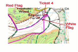 |
Bagden Farm from the west: the flags were placed in the foreground![Creative Commons Licence [Some Rights Reserved]](http://creativecommons.org/images/public/somerights20.gif) © Copyright
Shazz and licensed for reuse under this Creative Commons Licence.
© Copyright
Shazz and licensed for reuse under this Creative Commons Licence. |
The map here shows how we had intended Bagden Farm checkpoint to work. The flags were placed as shown to be seen as you rode across the field heading north, to draw you away from the loop round the buildings holding a ticket (4), thus the reason why red is on the right when you have your back to Bagden Farm. The idea was that if you did NOT go round the farmyard before entering the checkpoint you would miss the ticket and it would be noted by the checkpoint judge if you rode round that way after leaving this checkpoint, i.e. you could not "find" the ticket after reaching this checkpoint.
I placed the flags myself and realise now that I should have briefed the checkpoint judges better. However I was very disappointed to find out that a rider/riders arriving at the checkpoint convinced the checkpoint judges the flags were the wrong way round and the flags were swapped during the competition; If you find issues on a POR you should not hassle the checkpoint judges, you should note your complaint and raise it with the technical delegate (TD) or organiser on return to the venue.
I can only apologise to all who rode this section correctly, but due to the change of flags we had no option but to remove all penalties relating to this checkpoint and ticket.
Kay Kitson
Competition enquiries to Jenny Snowdon, tel: 07958 407594 email: jenny.snowdon@btopenworld.com
Enquiries about this page to Hugh Craddock, email: TREC@craddocks.co.uk
Results and report on the Mid Surrey BHS TREC 2014, Barwell BHS TREC 2013, the Barwell Court Farm BHS TREC 2011, the St Ebba's TRECs 2010, 2009, 2008, 2006 and Balanced TREC 2005
Page last updated: 1 April 2014