Lonely Lane (Betteshanger, Kent)
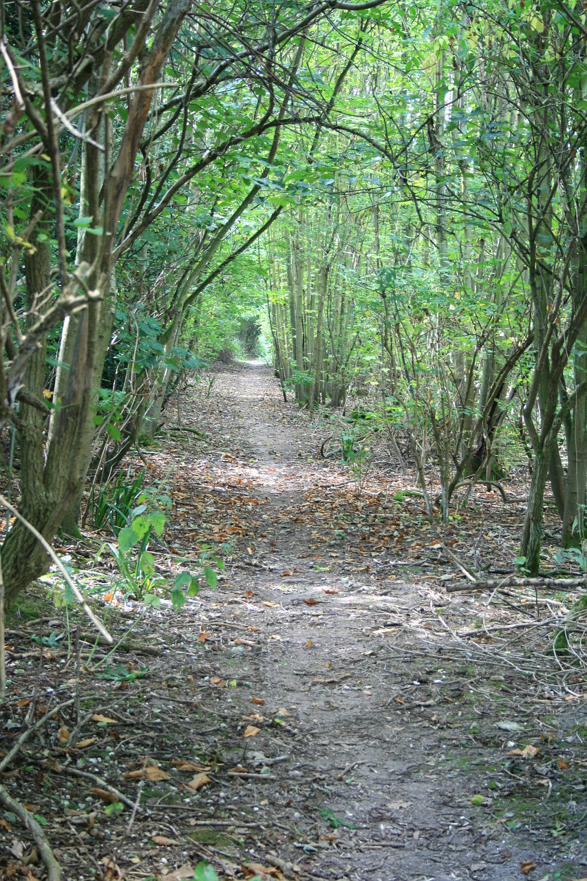
View south along the road, near the junction with Northbourne Road
This application on behalf of the British Horse Society was made to Kent County Council under section 53(5) of the Wildlife and Countryside Act 1981 on 6 October 2015 to modify the definitive map and statement for the county of Kent by adding a restricted byway, locally known as 'Lonely Lane', between Northbourne Road and Straight Mile, near Updown Park, Betteshanger, Kent.
Download the application document summary v.1.11 (4MB).
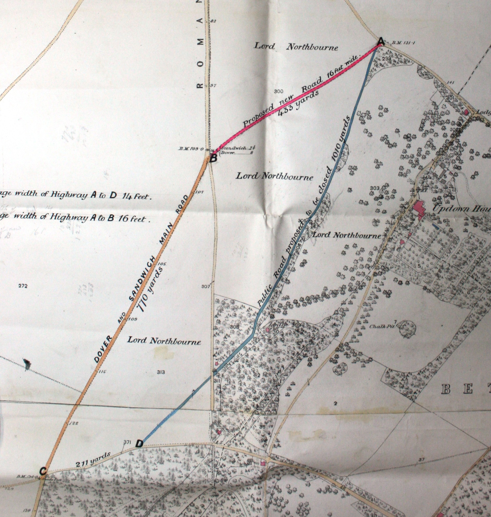
Download the 1892 magistrates' diversion order and map, and transcript of the magistrates' court order.
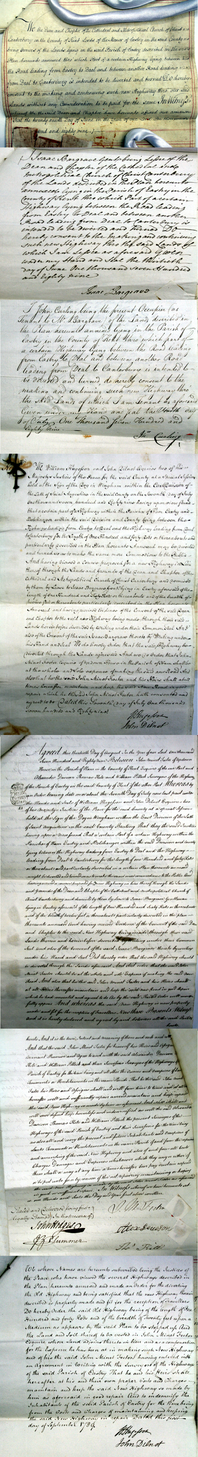
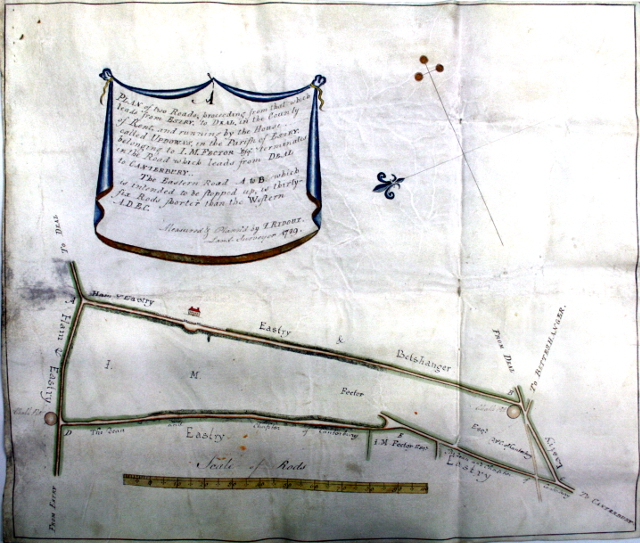
Download the 1789 magistrates' diversion order and map, and transcript of the magistrates' court order.
Images on Geograph.co.uk
Status: application made on 6 October 2015, acknowledged by Kent on 20 October 2015 and recorded in its register of applications under reference PROW/DO/C374.
Determined to grant application on 23 June 2021; order made on 21 July 2021 and closed to objections on 15 October 2021. Order confirmed on 18 November 2021. Application way recorded on definitive map and statement as restricted byway EE493.